Geolocate

Scot topographic map

Click on the map to display elevation.

About this map

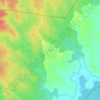
Name: Scot topographic map, elevation, terrain.

Location: Scot, Bura, Tana River County, Kenya (-0.07837 38.91195 -0.03837 38.95195)

Average elevation: 241 m

Minimum elevation: 213 m

Maximum elevation: 279 m

Gear up for your next adventure:

🧦Thermal Socks - Warm socks for winter hiking or camping
🪜Heavy Duty Carabiners - Multi-use clips for securing gear to your backpack
🧦Outdoor Socks - Durable socks designed for hiking and outdoor sports
🥾Waterproof Hiking Boots - Boots keeping your feet dry in wet conditions
💧Hydration Bladder - Hands-free hydration solution for long treks

As an Amazon Associate, this site earns from qualifying purchases at no extra cost to you.