Geolocate

Nocedo topographic map

Click on the map to display elevation.

About this map

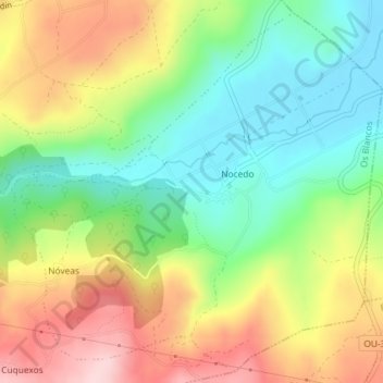
Name: Nocedo topographic map, elevation, terrain.

Location: Nocedo, Os Blancos, Limia, Orense, Galicia, 32632, España (41.97490 -7.73442 42.00019 -7.69935)

Average elevation: 739 m

Minimum elevation: 633 m

Maximum elevation: 890 m

Other topographic maps

Click on a map to view its topography, its elevation and its terrain.

Covelas

España > Galicia > Limia > Os Blancos

Average elevation: 735 m

Vilar de Covelas

España > Galicia > Limia > Os Blancos

Average elevation: 768 m

Loureses

España > Galicia > Limia > Os Blancos

Average elevation: 883 m

Gear up for your next adventure:

💧Collapsible Water Bottle - Space-saving water bottle for outdoor activities
🧢Outdoor Visor - Breathable visor for sunny hikes
🧢Sun Hat - Wide-brim hat for sun protection
🧳Compression Sacks - Maximize space in your backpack by shrinking gear
🔋Emergency Crank Radio - Weather alerts and power without needing batteries

As an Amazon Associate, this site earns from qualifying purchases at no extra cost to you.