Geolocate

Bismarck topographic map

Click on the map to display elevation.

About this map

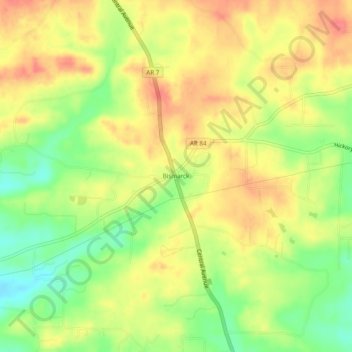
Name: Bismarck topographic map, elevation, terrain.

Location: Bismarck, Hot Spring County, Arkansas, 71929, United States (34.29620 -93.19073 34.33620 -93.15073)

Average elevation: 169 m

Minimum elevation: 133 m

Maximum elevation: 198 m

Other topographic maps

Click on a map to view its topography, its elevation and its terrain.

Malvern

United States > Arkansas > Hot Spring County

Average elevation: 101 m

Malvern

United States > Arkansas > Hot Spring County

Average elevation: 101 m

Gear up for your next adventure:

Bushcraft Tarp - Versatile emergency shelter or gear protection
🧢Outdoor Cap - Protective cap for sun and rain during hikes
🧣Evaporative Cooling Towel - Beat the heat during intense summer climbs
🥾Mountain Trail Shoes - High-traction shoes for mountain trails
🧭GPS Tracker - Track your location in remote areas safely

As an Amazon Associate, this site earns from qualifying purchases at no extra cost to you.