
Thank you for supporting this site ❤️
Make a donation
Make a donation
Gear up for your next adventure:
As an Amazon Associate, this site earns from qualifying purchases at no extra cost to you.
Ndokoa topographic map
Click on the map to display elevation.
Thank you for supporting this site ❤️
Make a donation
Make a donation
Gear up for your next adventure:
As an Amazon Associate, this site earns from qualifying purchases at no extra cost to you.
About this map
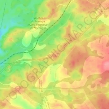
Name: Ndokoa topographic map, elevation, terrain.
Location: Ndokoa, Mbandjock, Haute-Sanaga, Centre, Cameroon (4.35529 11.71467 4.39529 11.75467)
Average elevation: 512 m
Minimum elevation: 458 m
Maximum elevation: 549 m
Thank you for supporting this site ❤️
Make a donation
Make a donation
Gear up for your next adventure:
As an Amazon Associate, this site earns from qualifying purchases at no extra cost to you.