
Make a donation
Gear up for your next adventure:
As an Amazon Associate, this site earns from qualifying purchases at no extra cost to you.
M'Hamid El Ghizlane topographic map
Click on the map to display elevation.
Make a donation
Gear up for your next adventure:
As an Amazon Associate, this site earns from qualifying purchases at no extra cost to you.
M'Hamid El Ghizlane
M'Hamid lies at an altitude of about 500 metres (1,600 ft) above sea level and about 24 kilometres (15 mi) from the Algerian border at the edge of the Sahara. M'Hamid can be reached at the end of National Route 9 from Ouarzazate (260 km) via Zagora (approx. 97 kilometres (60 mi)). Mhamid lies on the Wadi Draa, which rarely contains water.
Make a donation
Gear up for your next adventure:
As an Amazon Associate, this site earns from qualifying purchases at no extra cost to you.
About this map
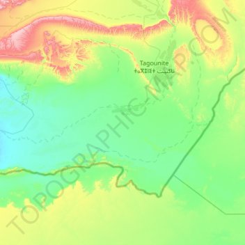
Name: M'Hamid El Ghizlane topographic map, elevation, terrain.
Average elevation: 642 m
Minimum elevation: 477 m
Maximum elevation: 1,270 m
Make a donation
Gear up for your next adventure:
As an Amazon Associate, this site earns from qualifying purchases at no extra cost to you.