Geolocate

Hato topographic map

Click on the map to display elevation.

About this map

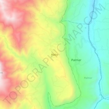
Name: Hato topographic map, elevation, terrain.

Location: Hato, Comunera, Santander, Colombia (6.50263 -73.34779 6.58263 -73.26779)

Average elevation: 1,177 m

Minimum elevation: 537 m

Maximum elevation: 2,154 m

Gear up for your next adventure:

🥾Waterproof Hiking Boots - Boots keeping your feet dry in wet conditions
🛌Down Sleeping Bag - Superior warmth-to-weight ratio for cold nights
🧢Hiking Hat - Sun-protective and breathable hats for long treks
🧥Ultralight Puffy Jacket - Maximum warmth that packs down to the size of an orange
🐕Hiking Dog Pack - Let your canine companion carry their own water and food

As an Amazon Associate, this site earns from qualifying purchases at no extra cost to you.