Geolocate

Wheatland topographic map

Click on the map to display elevation.

About this map

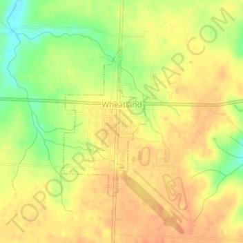
Name: Wheatland topographic map, elevation, terrain.

Location: Wheatland, Hickory County, Missouri, United States (37.93595 -93.40928 37.95244 -93.39752)

Average elevation: 319 m

Minimum elevation: 292 m

Maximum elevation: 332 m

Other topographic maps

Click on a map to view its topography, its elevation and its terrain.

Pittsburg

United States > Missouri > Hickory County

Average elevation: 291 m

Gear up for your next adventure:

🚲MTB Frame Bag - Carry tools and maps directly on your bicycle frame
💧Reusable Water Bottle - Durable water bottles for hydration on trails
🥾Trekking Boots - Durable boots for long-distance trekking
🧰Multitool Knife - Compact and versatile tool for outdoor use
🛶Kayak Accessories - Essential gear for safe and fun kayaking adventures

As an Amazon Associate, this site earns from qualifying purchases at no extra cost to you.