Geolocate

Sayhua topographic map

Click on the map to display elevation.

About this map

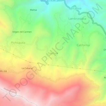
Name: Sayhua topographic map, elevation, terrain.

Location: Sayhua, Huancarama, Andahuaylas, Apurímac, Perú (-13.70145 -73.08302 -13.66145 -73.04302)

Average elevation: 3,628 m

Minimum elevation: 3,082 m

Maximum elevation: 4,224 m

Gear up for your next adventure:

🧭GPS Tracker - Track your location in remote areas safely
🧥Fleece Jacket - Warm and lightweight jacket for layering
🥾Lightweight Hiking Shoes - Comfortable shoes for day hikes
🧥Softshell Hiking Jacket - The perfect balance of wind protection and breathability
🚲Handlebar Phone Mount - View topographic-map.com live while cycling

As an Amazon Associate, this site earns from qualifying purchases at no extra cost to you.