Geolocate

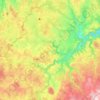
Laschamp topographic map

Click on the map to display elevation.

About this map

Name: Laschamp topographic map, elevation, terrain.

Location: Laschamp, Landogne, Riom, Puy-de-Dôme, Auvergne-Rhône-Alpes, France métropolitaine, 63380, France (45.86754 2.66476 45.90754 2.70476)

Average elevation: 597 m

Minimum elevation: 508 m

Maximum elevation: 695 m

Other topographic maps

Click on a map to view its topography, its elevation and its terrain.
63380

France > Auvergne-Rhône-Alpes > Puy-de-Dôme > Landogne > Magnol

Average elevation: 694 m

Gear up for your next adventure:

🥾Waterproof Trail Shoes - Shoes designed to handle wet terrain
🛶Kayak Accessories - Essential gear for safe and fun kayaking adventures
🧥Waterproof Jacket - Lightweight rain jackets for hiking and outdoor activities
🎒Hiking Backpack - Lightweight and ergonomic backpacks for day hikes or multi-day treks
🧴Waterproofing Spray - Restore the DWR coating on jackets and tents

As an Amazon Associate, this site earns from qualifying purchases at no extra cost to you.