Geolocate

Varde topographic map

Click on the map to display elevation.

About this map

Name: Varde topographic map, elevation, terrain.

Location: Varde, Varde Municipality, Region of Southern Denmark, 6800, Denmark (55.57767 8.44118 55.65767 8.52118)

Average elevation: 15 m

Minimum elevation: -1 m

Maximum elevation: 37 m

Other topographic maps

Click on a map to view its topography, its elevation and its terrain.

Funen

Denmark > Region of Southern Denmark

Average elevation: 19 m

Funen

Denmark > Region of Southern Denmark

Average elevation: 19 m

Funen

Denmark > Region of Southern Denmark

Average elevation: 19 m

Funen

Denmark > Region of Southern Denmark

Average elevation: 19 m

Rømø

Denmark > Region of Southern Denmark

Average elevation: 0 m

Skarø

Denmark > Region of Southern Denmark

Average elevation: 0 m

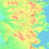
Guldbjerg

Denmark > Region of Southern Denmark

Average elevation: 23 m

Egholm

Denmark > Region of Southern Denmark

Average elevation: 0 m

Funen

Denmark > Region of Southern Denmark

Average elevation: 19 m

Funen

Denmark > Region of Southern Denmark

Average elevation: 19 m

Ærø

Denmark > Region of Southern Denmark

Average elevation: 3 m

Gear up for your next adventure:

🧣Evaporative Cooling Towel - Beat the heat during intense summer climbs
🎒Hiking Daypack - Lightweight and durable backpacks for day trips and excursions
🔋Lithium AA Batteries - Long-lasting power that performs in extreme cold
⛺Lightweight Backpacking Tent - Compact tent for efficient hiking trips
🧼Travel Hand Sanitizer - Keep hands clean when water is scarce

As an Amazon Associate, this site earns from qualifying purchases at no extra cost to you.