Geolocate

Taupō Bay topographic map

Click on the map to display elevation.

About this map

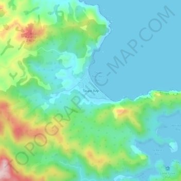
Name: Taupō Bay topographic map, elevation, terrain.

Location: Taupō Bay, Bay of Islands, Far North District, Northland, New Zealand (-35.01511 173.69015 -34.97511 173.73015)

Average elevation: 71 m

Minimum elevation: 0 m

Maximum elevation: 288 m

Other topographic maps

Click on a map to view its topography, its elevation and its terrain.

Gear up for your next adventure:

🥾All-Terrain Hiking Boots - Versatile boots for varied hiking conditions
🧴Bear Spray Holster - Quick-access carry for essential Canadian wilderness safety
🧭GPS Tracker - Track your location in remote areas safely
🧥Insulated Jacket - Keep warm in cold outdoor conditions
🪑Insulated Seat Pad - Protect your seat from cold rocks and wet logs

As an Amazon Associate, this site earns from qualifying purchases at no extra cost to you.