Geolocate

Pico Pienzo topographic map

Click on the map to display elevation.

About this map
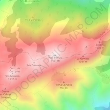
Name: Pico Pienzo topographic map, elevation, terrain.

Location: Pico Pienzo, Colunga, Asturias, 33342, España (43.43184 -5.24222 43.43194 -5.24212)

Average elevation: 819 m

Minimum elevation: 349 m

Maximum elevation: 1,146 m

Other topographic maps

Click on a map to view its topography, its elevation and its terrain.

Lastres

España > Asturias > Colunga

Average elevation: 89 m

Gear up for your next adventure:

🥾Durable Hiking Shoes - Long-lasting shoes for frequent hiking
🐕Hiking Dog Pack - Let your canine companion carry their own water and food
🧣Evaporative Cooling Towel - Beat the heat during intense summer climbs
🧥Softshell Jacket - Windproof and breathable jacket for hiking
🧥Waterproof Hiking Jacket - Protect yourself from rain and wind while hiking

As an Amazon Associate, this site earns from qualifying purchases at no extra cost to you.