Geolocate

Proper topographic map

Click on the map to display elevation.

About this map
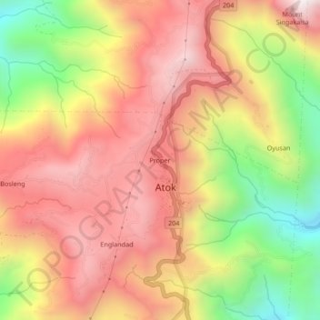
Name: Proper topographic map, elevation, terrain.

Location: Proper, Paoay, Atok, Benguet, Cordillera Administrative Region, 2612, Philippines (16.61087 120.74603 16.65087 120.78603)

Average elevation: 2,090 m

Minimum elevation: 1,460 m

Maximum elevation: 2,553 m

Other topographic maps

Click on a map to view its topography, its elevation and its terrain.

Paoay

Philippines > Benguet > Atok

Average elevation: 1,771 m

Paoay

Philippines > Benguet > Atok

Average elevation: 1,771 m

Paoay

Philippines > Benguet > Atok

Average elevation: 1,771 m

Gear up for your next adventure:

🧥Waterproof Pants - Keep dry during rainy hiking conditions
🕶️Polarized Sunglasses - Reduces glare from snow and water at high elevations
🧥Softshell Hiking Jacket - The perfect balance of wind protection and breathability
🧰Survival Kit - Essential gear for emergencies in the wilderness
💡LED Camping Lantern - Illuminate your campsite with long-lasting lanterns

As an Amazon Associate, this site earns from qualifying purchases at no extra cost to you.