Geolocate

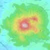
Juban topographic map

Click on the map to display elevation.

About this map
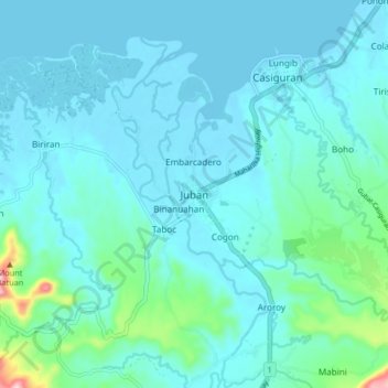
Name: Juban topographic map, elevation, terrain.

Location: Juban, Sorsogon, Bicol Region, 4702, Philippines (12.80789 123.94908 12.88789 124.02908)

Average elevation: 30 m

Minimum elevation: -2 m

Maximum elevation: 250 m

Other topographic maps

Click on a map to view its topography, its elevation and its terrain.
Calintaan Island

Philippines > Sorsogon > Calintaan

Average elevation: 6 m

Castilla

Philippines > Sorsogon

Average elevation: 83 m

Pilar

Philippines > Sorsogon

Average elevation: 24 m

Donsol

Philippines > Sorsogon

Average elevation: 20 m

Bulusan Lake

Philippines > Sorsogon > San Roque

Lake Bulusan is a lake on Luzon Island in the Philippines. It lies at the heart of Bulusan Volcano National Park which covers a land area of 3,672 hectares (9,070 acres). It has an elevation of 360 metres (1,180 ft) and is located on the southeast flank of Mount Bulusan, an active volcano.

Average elevation: 382 m

Sorsogon River

Philippines > Sorsogon > Sorsogon City

Average elevation: 19 m

Castilla

Philippines > Sorsogon

Average elevation: 83 m

J.Gerona (Biton)

Philippines > Sorsogon

Average elevation: 12 m

Castilla

Philippines > Sorsogon

Average elevation: 83 m

Donsol

Philippines > Sorsogon

Average elevation: 20 m

Donsol

Philippines > Sorsogon

Average elevation: 20 m

Gear up for your next adventure:

🚑Survival Whistle - Signal for help across long distances in mountains
👟Trail Running Shoes - Agile footwear for fast-paced topographic exploration
🥾Hiking Leggings - Comfortable leggings for outdoor activities
🏃Hydration Running Vest - Carry water and maps close to your body for speed
🥾Approach Boots - Comfortable boots for hiking and climbing approaches

As an Amazon Associate, this site earns from qualifying purchases at no extra cost to you.