Geolocate

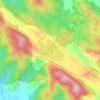
Jagti topographic map

Click on the map to display elevation.

About this map

Name: Jagti topographic map, elevation, terrain.

Location: Jagti, Jammu, Jammu district, Jammu and Kashmir, 181221, India (32.78845 74.87582 32.82845 74.91582)

Average elevation: 400 m

Minimum elevation: 337 m

Maximum elevation: 541 m

Other topographic maps

Click on a map to view its topography, its elevation and its terrain.

Jhajjar Nala

India > Jammu and Kashmir > Jammu > Domel

Average elevation: 559 m

Surinsar Lake

India > Jammu and Kashmir > Jammu

Average elevation: 577 m

Gear up for your next adventure:

🥾Mountain Trail Shoes - High-traction shoes for mountain trails
🚲Heavy Duty Bike Lock - Secure your bike at the trailhead or during stops
👟Sport Hiking Sandals - Breathable footwear for water crossings and camp rest
🥾Hiking Leggings - Comfortable leggings for outdoor activities
🥾Light Trekking Boots - Supportive boots for multi-day treks

As an Amazon Associate, this site earns from qualifying purchases at no extra cost to you.