Geolocate

Leith topographic map

Click on the map to display elevation.

About this map

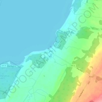
Name: Leith topographic map, elevation, terrain.

Location: Leith, Meaford, Grey County, Ontario, Canada (44.60517 -80.89564 44.64517 -80.85564)

Average elevation: 197 m

Minimum elevation: 174 m

Maximum elevation: 277 m

Grey County trails, hiking, mountain biking, running and outdoor activities

Gear up for your next adventure:

🕶️Polarized Sunglasses - Reduces glare from snow and water at high elevations
💧Collapsible Water Bottle - Space-saving water bottle for outdoor activities
Camping Essentials - All-in-one gear for a comfortable camping trip
🧦Crew Hiking Socks - Comfortable socks for long-distance hikes
🧢Hiking Hat - Sun-protective and breathable hats for long treks

As an Amazon Associate, this site earns from qualifying purchases at no extra cost to you.