Geolocate

Leer topographic map

Click on the map to display elevation.

About this map
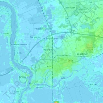
Name: Leer topographic map, elevation, terrain.

Location: Leer, Landkreis Leer, Nedersaksen, 26789, Duitsland (53.20294 7.36689 53.29229 7.54315)

Average elevation: 2 m

Minimum elevation: -5 m

Maximum elevation: 25 m

Other topographic maps

Click on a map to view its topography, its elevation and its terrain.

Ödenfeld

Duitsland > Nedersaksen > Landkreis Leer > Weener > Holthusen

Average elevation: 3 m

Wymeer

Duitsland > Nedersaksen > Landkreis Leer

Average elevation: 1 m

Stapelmoor

Duitsland > Nedersaksen > Landkreis Leer > Weener

Average elevation: 3 m

Bunderhee

Duitsland > Nedersaksen > Landkreis Leer

Average elevation: 1 m

Gear up for your next adventure:

🥾Trekking Boots - Durable boots for long-distance trekking
🧦Hiking Socks - Moisture-wicking and comfortable socks for long hikes
🥾Hiking Boots - Sturdy boots providing ankle support and traction on rugged trails
🥾Waterproof Trail Shoes - Shoes designed to handle wet terrain
🔦UV Flashlight - Detect minerals or specific insects in the dark

As an Amazon Associate, this site earns from qualifying purchases at no extra cost to you.