Geolocate

Castle Hill topographic map

Click on the map to display elevation.

About this map

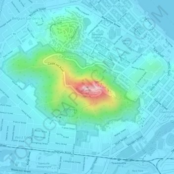
Name: Castle Hill topographic map, elevation, terrain.

Location: Castle Hill, Townsville, Queensland, 4810, Australia (-19.25808 146.80257 -19.25798 146.80267)

Average elevation: 40 m

Minimum elevation: -1 m

Maximum elevation: 275 m

Other topographic maps

Click on a map to view its topography, its elevation and its terrain.

Pallarenda

Australia > Queensland > Townsville

Average elevation: 14 m

Magnetic Island

Australia > Queensland > Townsville

Average elevation: 54 m

Stuart Creek

Australia > Queensland > Townsville

Average elevation: 6 m

Cape Pallarenda

Australia > Queensland > Townsville

Average elevation: 12 m

Gear up for your next adventure:

🧢Sun Protection Cap - Breathable cap to protect from sun exposure
Camping Groundsheet - Protect your tent from moisture and dirt
🧥Insulated Jacket - Keep warm in cold outdoor conditions
Lightweight Camping Tent - Portable shelter optimized for Canadian backcountry camping
🥾Hiking Shorts - Breathable shorts suitable for summer hikes

As an Amazon Associate, this site earns from qualifying purchases at no extra cost to you.