Geolocate

Puhpelem topographic map

Click on the map to display elevation.

About this map

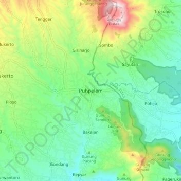
Name: Puhpelem topographic map, elevation, terrain.

Location: Puhpelem, Wonogiri, Central Java, Java, Indonesia (-7.83630 111.24208 -7.75630 111.32208)

Average elevation: 454 m

Minimum elevation: 236 m

Maximum elevation: 949 m

Gear up for your next adventure:

🐕Hiking Dog Pack - Let your canine companion carry their own water and food
💡Portable Camping Lamp - Rechargeable lamp for campsite lighting
🧦Hiking Socks - Moisture-wicking and comfortable socks for long hikes
🥾Approach Boots - Comfortable boots for hiking and climbing approaches
🩹Moleskin Blister Pads - Direct protection for painful foot pressure points

As an Amazon Associate, this site earns from qualifying purchases at no extra cost to you.