Geolocate

Patianrowo topographic map

Click on the map to display elevation.

About this map

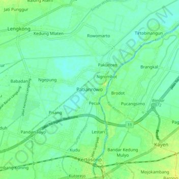
Name: Patianrowo topographic map, elevation, terrain.

Location: Patianrowo, Nganjuk, East Java, Java, 64311, Indonesia (-7.60147 112.06699 -7.52147 112.14699)

Average elevation: 41 m

Minimum elevation: 34 m

Maximum elevation: 53 m

Other topographic maps

Click on a map to view its topography, its elevation and its terrain.

Ngronggot

Indonesia > East Java > Nganjuk

Average elevation: 50 m

Ngronggot

Indonesia > East Java > Nganjuk

Average elevation: 51 m

Kaloran

Indonesia > East Java > Nganjuk

Average elevation: 46 m

Kelurahan

Indonesia > East Java > Nganjuk

Average elevation: 47 m

Banjarsari

Indonesia > East Java > Nganjuk

Average elevation: 49 m

Gear up for your next adventure:

💧Hydration Pack - Hands-free hydration system for long hikes
🧣Merino Neck Gaiter - Protects against wind, sun, and cold at high altitudes
Family Camping Tent - Spacious tent suitable for family camping trips
Tent Footprint - Protect tent floor and increase durability
Camping Groundsheet - Protect your tent from moisture and dirt

As an Amazon Associate, this site earns from qualifying purchases at no extra cost to you.