Geolocate

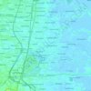
Kedungrejo topographic map

Click on the map to display elevation.

About this map

Name: Kedungrejo topographic map, elevation, terrain.

Location: Kedungrejo, Waru, Sidoarjo, East Java, Java, 61256, Indonesia (-7.37223 112.71111 -7.33223 112.75111)

Average elevation: 6 m

Minimum elevation: 0 m

Maximum elevation: 10 m

Other topographic maps

Click on a map to view its topography, its elevation and its terrain.
Jabon

Indonesia > East Java > Sidoarjo

Average elevation: 3 m

Candi

Indonesia > East Java > Sidoarjo

Average elevation: 3 m

Tulangan

Indonesia > East Java > Sidoarjo

Average elevation: 8 m

Sukodono

Indonesia > East Java > Sidoarjo

Average elevation: 8 m

Krembung

Indonesia > East Java > Sidoarjo

Average elevation: 10 m

Prambon

Indonesia > East Java > Sidoarjo

Average elevation: 13 m

Tanggulangin

Indonesia > East Java > Sidoarjo

Average elevation: 3 m

Gear up for your next adventure:

⛺Camping Groundsheet - Protect your tent from moisture and dirt
🧣Evaporative Cooling Towel - Beat the heat during intense summer climbs
🧢Beanie Hat - Keep your head warm in cold weather
🥾Approach Shoes - Shoes designed for climbing approaches and rugged trails
⛺Bushcraft Tarp - Versatile emergency shelter or gear protection

As an Amazon Associate, this site earns from qualifying purchases at no extra cost to you.