Geolocate

Sama topographic map

Click on the map to display elevation.

About this map

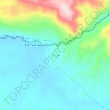
Name: Sama topographic map, elevation, terrain.

Location: Sama, Jayapura, Papua, Western New Guinea, Indonesia (-2.64412 140.32410 -2.60412 140.36410)

Average elevation: 168 m

Minimum elevation: 72 m

Maximum elevation: 462 m

Gear up for your next adventure:

🥾Waterproof Hiking Boots - Essential footwear for rugged terrain and wet Canadian trails
🎒Hiking Backpack - Lightweight and ergonomic backpacks for day hikes or multi-day treks
💡Compact LED Flashlight - Powerful and portable flashlight for outdoor use
🔭Outdoor Binoculars - Lightweight binoculars for birdwatching and hiking
🥾Trail Hiking Boots - Supportive boots for rough trails

As an Amazon Associate, this site earns from qualifying purchases at no extra cost to you.