Geolocate

lahei topographic map

Click on the map to display elevation.

About this map

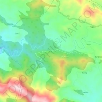
Name: lahei topographic map, elevation, terrain.

Location: lahei, Kalakote, Rajouri District, Jammu and Kashmir, India (33.20733 74.32184 33.24733 74.36184)

Average elevation: 826 m

Minimum elevation: 694 m

Maximum elevation: 1,063 m

Gear up for your next adventure:

💧Hydration Pack - Hands-free hydration system for long hikes
🧊Portable Cooler - Keep food and drinks cold during outdoor adventures
🧣Merino Neck Gaiter - Protects against wind, sun, and cold at high altitudes
🛰️Satellite Messenger - Emergency communication for areas with no cell service
🔋Solar Power Bank - Keep your GPS and devices charged during long outdoor trips

As an Amazon Associate, this site earns from qualifying purchases at no extra cost to you.