Geolocate

Santa Ninfa topographic map

Click on the map to display elevation.

About this map

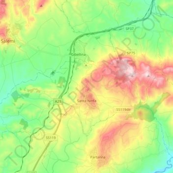
Name: Santa Ninfa topographic map, elevation, terrain.

Location: Santa Ninfa, Trapani, Sicily, 91029, Italy (37.73643 12.76199 37.82762 12.93041)

Average elevation: 294 m

Minimum elevation: 68 m

Maximum elevation: 665 m

Gear up for your next adventure:

🧶550 Survival Paracord - Versatile utility cord for emergency repairs and rigging
🥫Freeze-Dried Meals - Lightweight, high-calorie nutrition for multi-day treks
🍽️Titanium Camping Spork - Ultralight and indestructible eating utensil
👟Sport Hiking Sandals - Breathable footwear for water crossings and camp rest
💡LED Headlamp - Hands-free illumination for night hiking and camping

As an Amazon Associate, this site earns from qualifying purchases at no extra cost to you.