Geolocate

Godumbre topographic map

Click on the map to display elevation.

About this map

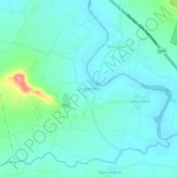
Name: Godumbre topographic map, elevation, terrain.

Location: Godumbre, Mawal, Pune District, Maharashtra, 410506, India (18.64932 73.66028 18.68932 73.70028)

Average elevation: 587 m

Minimum elevation: 564 m

Maximum elevation: 694 m

Other topographic maps

Click on a map to view its topography, its elevation and its terrain.

Patan

India > Maharashtra > Mawal

Average elevation: 689 m

Kasarsai

India > Maharashtra > Mawal > Pachane

Average elevation: 654 m

Tung Fort

India > Maharashtra > Mawal

Average elevation: 733 m

Tikona Fort

India > Maharashtra > Mawal > Tikona Peth

Average elevation: 742 m

Pavana Dam

India > Maharashtra > Mawal > Kale Colony

Average elevation: 610 m

Gear up for your next adventure:

🚲MTB Frame Bag - Carry tools and maps directly on your bicycle frame
Tent Footprint - Protect tent floor and increase durability
🧦Outdoor Socks - Durable socks designed for hiking and outdoor sports
🛌Down Sleeping Bag - Superior warmth-to-weight ratio for cold nights
🌡️Emergency Mylar Blankets - Compact thermal protection for unexpected nights outdoors

As an Amazon Associate, this site earns from qualifying purchases at no extra cost to you.