Geolocate

Camocim topographic map

Click on the map to display elevation.

About this map
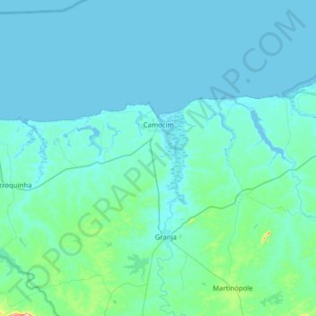
Name: Camocim topographic map, elevation, terrain.

Location: Camocim, Região Geográfica Imediata de Camocim, Região Geográfica Intermediária de Sobral, Ceará, Northeast Region, 62400-000, Brazil (-3.09384 -41.11958 -2.84124 -40.49502)

Average elevation: 25 m

Minimum elevation: -2 m

Maximum elevation: 408 m

Other topographic maps

Click on a map to view its topography, its elevation and its terrain.
Buenos Aries

Brazil > Ceará > Alcântaras

Average elevation: 743 m

Machuca

Brazil > Ceará > Aquiraz

Average elevation: 19 m

Gear up for your next adventure:

🧳Compression Sacks - Maximize space in your backpack by shrinking gear
🧥Packable Rain Jacket - Breathable waterproof layer for unpredictable weather
🧥Softshell Jacket - Windproof and breathable jacket for hiking
🥾Durable Hiking Shoes - Long-lasting shoes for frequent hiking
🥾Waterproof Hiking Boots - Essential footwear for rugged terrain and wet Canadian trails

As an Amazon Associate, this site earns from qualifying purchases at no extra cost to you.