Geolocate

Grange topographic map

Click on the map to display elevation.

About this map

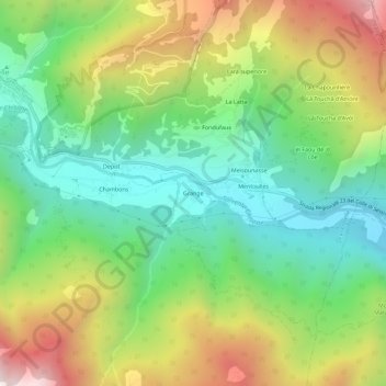
Name: Grange topographic map, elevation, terrain.

Location: Grange, Fenestrelle, Torino, Piedmont, Italy (45.00356 7.05942 45.04356 7.09942)

Average elevation: 1,430 m

Minimum elevation: 963 m

Maximum elevation: 2,186 m

Gear up for your next adventure:

👖Convertible Hiking Pants - Zip-off legs to adapt to changing weather conditions
🪜Heavy Duty Carabiners - Multi-use clips for securing gear to your backpack
🛌Down Sleeping Bag - Superior warmth-to-weight ratio for cold nights
🧼Travel Hand Sanitizer - Keep hands clean when water is scarce
🧦Thermal Socks - Warm socks for winter hiking or camping

As an Amazon Associate, this site earns from qualifying purchases at no extra cost to you.