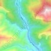
Khambu topographic map
Click on the map to display elevation.
About this map

Name: Khambu topographic map, elevation, terrain.
Location: Khambu, Yadong County, Shigatse Prefecture, Tibet, China (27.55329 88.83606 27.94122 89.06526)
Average elevation: 4,632 m
Minimum elevation: 2,754 m
Maximum elevation: 7,005 m
Other topographic maps
Click on a map to view its topography, its elevation and its terrain.
Nathu La
China > Tibet > Yadong County > Xiayadong
Nathu La is a mountain pass on the Dongkya Range that separates Sikkim and the Chumbi Valley at an elevation of 14,250 feet (4,340 m). The pass is 52–54 kilometres (32–34 mi) east of Gangtok, the capital of Sikkim, and 35 kilometres (22 mi) from Yatung Shasima, the headquarters of the Yadong County (or the…
Average elevation: 4,240 m