Geolocate

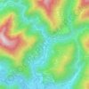
Stroppiana topographic map

Click on the map to display elevation.

About this map

Name: Stroppiana topographic map, elevation, terrain.

Location: Stroppiana, Vercelli, Piemonte, Italia (45.20059 8.42892 45.26027 8.48187)

Average elevation: 119 m

Minimum elevation: 109 m

Maximum elevation: 130 m

Other topographic maps

Click on a map to view its topography, its elevation and its terrain.

Rolate

Italia > Piemonte > Vercelli > Varallo > Camasco

Average elevation: 933 m

Ferrera

Italia > Piemonte > Vercelli > Cravagliana

Average elevation: 1,019 m

Roasio Santa Maria

Italia > Piemonte > Vercelli

Average elevation: 294 m

Sant'Antonino

Italia > Piemonte > Vercelli > Saluggia

Average elevation: 188 m

Bocchetta delle Pisse

Italia > Piemonte > Vercelli > Alagna Valsesia

Average elevation: 2,235 m

Cesolo

Italia > Piemonte > Vercelli > Borgosesia

Average elevation: 457 m

Gear up for your next adventure:

🧰Survival Kit - Essential gear for emergencies in the wilderness
🥾Waterproof Hiking Boots - Boots keeping your feet dry in wet conditions
🔭Compact Binoculars - Lightweight optics for scouting trails and wildlife
🧥Softshell Jacket - Windproof and breathable jacket for hiking
⛺Family Camping Tent - Spacious tent suitable for family camping trips

As an Amazon Associate, this site earns from qualifying purchases at no extra cost to you.