
Thank you for supporting this site ❤️
Make a donation
Make a donation
Gear up for your next adventure:
As an Amazon Associate, this site earns from qualifying purchases at no extra cost to you.
Ballıkaya topographic map
Click on the map to display elevation.
Thank you for supporting this site ❤️
Make a donation
Make a donation
Gear up for your next adventure:
As an Amazon Associate, this site earns from qualifying purchases at no extra cost to you.
About this map
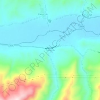
Name: Ballıkaya topographic map, elevation, terrain.
Location: Ballıkaya, Bayburt, Black Sea Region, Turkey (40.35238 40.36888 40.39238 40.40888)
Average elevation: 1,557 m
Minimum elevation: 1,446 m
Maximum elevation: 1,934 m
Thank you for supporting this site ❤️
Make a donation
Make a donation
Gear up for your next adventure:
As an Amazon Associate, this site earns from qualifying purchases at no extra cost to you.