Geolocate

Shillai topographic map

Click on the map to display elevation.

About this map

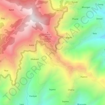
Name: Shillai topographic map, elevation, terrain.

Location: Shillai, Shalai, Sirmaur, Himachal Pradesh, 173027, India (30.65691 77.68693 30.69691 77.72693)

Average elevation: 1,556 m

Minimum elevation: 946 m

Maximum elevation: 2,183 m

Gear up for your next adventure:

🧰Multitool Knife - Compact and versatile tool for outdoor use
🛶Waterproof Dry Bags - Keep electronics and clothes dry during river crossings
🥾Trail Hiking Boots - Supportive boots for rough trails
🥾Trekking Boots - Durable boots for long-distance trekking
🕯️Camping Lantern - Illuminates your entire campsite with high-efficiency LEDs

As an Amazon Associate, this site earns from qualifying purchases at no extra cost to you.