
Soiernspitze topographic map
Click on the map to display elevation.
About this map
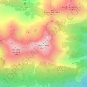
Name: Soiernspitze topographic map, elevation, terrain.
Average elevation: 1,743 m
Minimum elevation: 1,155 m
Maximum elevation: 2,251 m
Other topographic maps
Click on a map to view its topography, its elevation and its terrain.
Soierngruppe
Deutschland > Bayern > Landkreis Garmisch-Partenkirchen > Mittenwald
Im Kessel befindet sich auf einer Höhe von 1616 m ü. NHN das Obere Soiernhaus des Deutschen Alpenvereins (DAV). Die Soiernhäuser wurden ursprünglich von König Ludwig II. errichtet. Bei den Soiernseen (1558 m ü. NHN bzw. 1549 m ü. NHN) liegt das ehemalige Diener- und Wirtschaftsgebäude, das heute von…
Average elevation: 1,260 m
Ferchensee
Deutschland > Bayern > Landkreis Garmisch-Partenkirchen > Mittenwald
Average elevation: 1,282 m