Geolocate

Kersbach topographic map

Click on the map to display elevation.

Kersbach

Der Ort ist an die Buslinie Neunkirchen am Brand–Forchheim (VGN 224) und der Bahnhaltepunkt an die Buslinie Oesdorf-Heroldsbach-Forchheim (VGN 216) angeschlossen. Eine neue Busverbindung (VGN 260) von Kersbach nach Forchheim mit den Haltestellen Waldstraße, Wilhelmshöhe und Irrlrinnig wurde eingerichtet. Kersbach ist in etwa 30 Minuten vom internationalen Flughafen Nürnberg aus zu erreichen.

Wikipedia (CC-BY-SA 3.0)

About this map

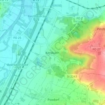
Name: Kersbach topographic map, elevation, terrain.

Location: Kersbach, Forchheim, Landkreis Forchheim, Bayern, 91301, Deutschland (49.66162 11.05064 49.70162 11.09064)

Average elevation: 284 m

Minimum elevation: 256 m

Maximum elevation: 362 m

Gear up for your next adventure:

🎒Fully Waterproof Backpack - Total protection for photography gear and electronics
🥾Hiking Boots - Sturdy boots providing ankle support and traction on rugged trails
🧴Insect Repellent - Protect yourself from bugs during outdoor adventures
🚑Survival Whistle - Signal for help across long distances in mountains
🚲Heavy Duty Bike Lock - Secure your bike at the trailhead or during stops

As an Amazon Associate, this site earns from qualifying purchases at no extra cost to you.