Geolocate

Tuljapur topographic map

Click on the map to display elevation.

Tuljapur

It has an elevation of 648 metres (2125 feet).

Wikipedia (CC-BY-SA 3.0)

About this map

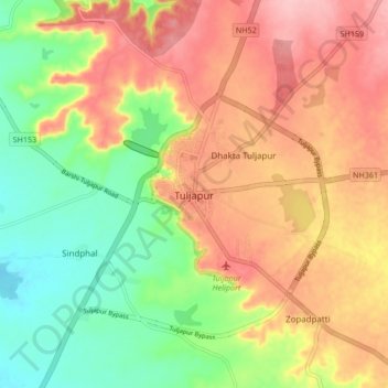
Name: Tuljapur topographic map, elevation, terrain.

Location: Tuljapur, Dharashiv District, 413600, India (17.96866 76.03079 18.04866 76.11079)

Average elevation: 611 m

Minimum elevation: 541 m

Maximum elevation: 679 m

Gear up for your next adventure:

🧴Bear Spray Holster - Quick-access carry for essential Canadian wilderness safety
🥫Freeze-Dried Meals - Lightweight, high-calorie nutrition for multi-day treks
🥾Lightweight Hiking Boots - Boots for comfort and mobility on long hikes
Lightweight Backpacking Tent - Compact tent for efficient hiking trips
🥾Waterproof Hiking Shoes - Durable shoes for wet and rugged trails

As an Amazon Associate, this site earns from qualifying purchases at no extra cost to you.