Geolocate

Bahau topographic map

Click on the map to display elevation.

About this map

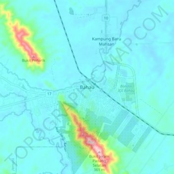
Name: Bahau topographic map, elevation, terrain.

Location: Bahau, Jempol, Negeri Sembilan, 72100, Malaysia (2.77001 102.36043 2.85001 102.44043)

Average elevation: 84 m

Minimum elevation: 50 m

Maximum elevation: 343 m

Gear up for your next adventure:

🥾Waterproof Hiking Boots - Essential footwear for rugged terrain and wet Canadian trails
🔨Vehicle Emergency Tool - Safety tool for remote road trips to trailheads
🛶Kayak Dry Bag - Waterproof storage for kayaking adventures
🧊Insulated Water Bottle - Keeps drinks cold in summer and prevents freezing in winter
🛌Insulated Sleeping Pad - Critical thermal barrier between you and the cold ground

As an Amazon Associate, this site earns from qualifying purchases at no extra cost to you.