Geolocate

Sukakarya topographic map

Click on the map to display elevation.

About this map

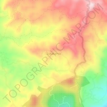
Name: Sukakarya topographic map, elevation, terrain.

Location: Sukakarya, Cianjur, West Java, Java, 43266, Indonesia (-7.16485 107.08512 -7.12485 107.12512)

Average elevation: 836 m

Minimum elevation: 626 m

Maximum elevation: 998 m

Other topographic maps

Click on a map to view its topography, its elevation and its terrain.

Kertajadi

Indonesia > West Java > Cianjur

Average elevation: 108 m

Agrabinta

Indonesia > West Java > Cianjur

Average elevation: 108 m

Cidaun

Indonesia > West Java > Cianjur

Average elevation: 658 m

Karangwangi

Indonesia > West Java > Cianjur

Average elevation: 119 m

Wanasari

Indonesia > West Java > Cianjur

Average elevation: 31 m

Jayapura

Indonesia > West Java > Cianjur

Average elevation: 73 m

Cisalak

Indonesia > West Java > Cianjur

Average elevation: 49 m

Gear up for your next adventure:

🌡️Emergency Mylar Blankets - Compact thermal protection for unexpected nights outdoors
🥾Trail Hiking Socks - Comfortable socks to prevent blisters and fatigue
🧣Evaporative Cooling Towel - Beat the heat during intense summer climbs
🥾Mountain Hiking Shoes - Shoes with superior grip for mountainous terrain
🛌Insulated Sleeping Pad - Critical thermal barrier between you and the cold ground

As an Amazon Associate, this site earns from qualifying purchases at no extra cost to you.