
Landeck topographic map
Click on the map to display elevation.
Landeck
Landeck is located in the Tyrolean Oberland in the west of the state at an elevation of about 820 m (2,690 ft). The town is situated in the valley of the Inn River at the confluence with the Sanna tributary, between the Lechtal Alps, part of the Northern Limestone Alps in the north, and the Ötztal Alps and Samnaun Alps ranges of the Central Eastern Alps in the south.
About this map
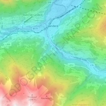
Name: Landeck topographic map, elevation, terrain.
Location: Landeck, Bezirk Landeck, Tyrol, 6500, Austria (47.09818 10.52642 47.15665 10.60537)
Average elevation: 1,325 m
Minimum elevation: 764 m
Maximum elevation: 2,582 m
Other topographic maps
Click on a map to view its topography, its elevation and its terrain.