
Thank you for supporting this site ❤️
Make a donation
Make a donation
Gear up for your next adventure:
As an Amazon Associate, this site earns from qualifying purchases at no extra cost to you.
Inver topographic map
Click on the map to display elevation.
Thank you for supporting this site ❤️
Make a donation
Make a donation
Gear up for your next adventure:
As an Amazon Associate, this site earns from qualifying purchases at no extra cost to you.
About this map
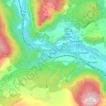
Name: Inver topographic map, elevation, terrain.
Location: Inver, Perth and Kinross, Scotland, PH8 0JR, United Kingdom (56.54107 -3.62193 56.58107 -3.58193)
Average elevation: 161 m
Minimum elevation: 40 m
Maximum elevation: 390 m
Thank you for supporting this site ❤️
Make a donation
Make a donation
Gear up for your next adventure:
As an Amazon Associate, this site earns from qualifying purchases at no extra cost to you.