Geolocate

Celuk topographic map

Click on the map to display elevation.

About this map

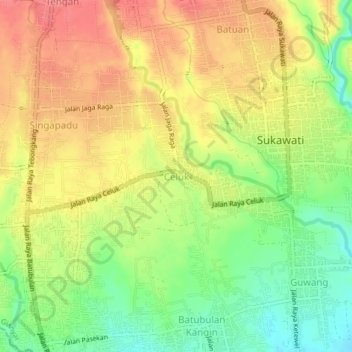
Name: Celuk topographic map, elevation, terrain.

Location: Celuk, Gianyar, Bali, Lesser Sunda Islands, 80582, Indonesia (-8.62033 115.25006 -8.58033 115.29006)

Average elevation: 65 m

Minimum elevation: 25 m

Maximum elevation: 99 m

Other topographic maps

Click on a map to view its topography, its elevation and its terrain.

Ubud District

Indonesia > Bali > Gianyar

Average elevation: 198 m

Pejeng

Indonesia > Bali > Gianyar

Average elevation: 201 m

Gear up for your next adventure:

🧥Insulated Jacket - Keep warm in cold outdoor conditions
🦶Anti-Blister Balm - Prevents friction and hotspots during long ascents
🧦Crew Hiking Socks - Comfortable socks for long-distance hikes
🔋Lithium AA Batteries - Long-lasting power that performs in extreme cold
🛶Waterproof Dry Bags - Keep electronics and clothes dry during river crossings

As an Amazon Associate, this site earns from qualifying purchases at no extra cost to you.