Geolocate

ñunya Temple topographic map

Click on the map to display elevation.

About this map

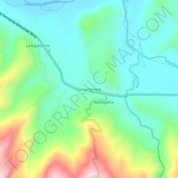
Name: ñunya Temple topographic map, elevation, terrain.

Location: ñunya Temple, Bagua Grande, Utcubamba, Amazonas, Perú (-5.83738 -78.32811 -5.79738 -78.28811)

Average elevation: 569 m

Minimum elevation: 460 m

Maximum elevation: 831 m

Gear up for your next adventure:

💧Collapsible Water Bottle - Space-saving water bottle for outdoor activities
🥾Waterproof Hiking Shoes - Durable shoes for wet and rugged trails
🥾Trail Hiking Shoes - Durable shoes designed for rugged trails
🧴Outdoor Sunscreen - High SPF protection for high-altitude UV exposure
🥽Outdoor Goggles - Protective eyewear for outdoor activities

As an Amazon Associate, this site earns from qualifying purchases at no extra cost to you.