Geolocate

Parbalpur topographic map

Click on the map to display elevation.

About this map

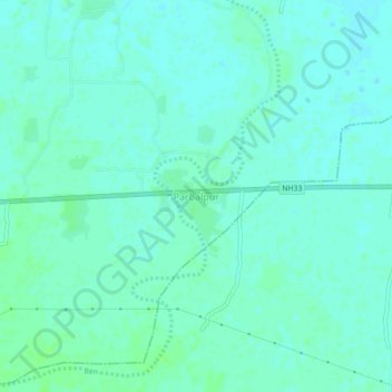
Name: Parbalpur topographic map, elevation, terrain.

Location: Parbalpur, Nalanda, Bihar, 845422, India (25.18840 85.34619 25.22840 85.38619)

Average elevation: 55 m

Minimum elevation: 51 m

Maximum elevation: 59 m

Gear up for your next adventure:

🛏️Sleeping Bag - Warm and compact sleeping bags for outdoor camping
🥾Hiking Shorts - Breathable shorts suitable for summer hikes
🧥Packable Rain Jacket - Breathable waterproof layer for unpredictable weather
💧Hydration Bladder - Hands-free hydration solution for long treks
💡Portable Camping Lamp - Rechargeable lamp for campsite lighting

As an Amazon Associate, this site earns from qualifying purchases at no extra cost to you.