
Paternion topographic map
Click on the map to display elevation.
About this map
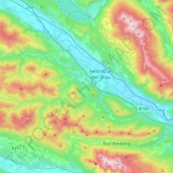
Name: Paternion topographic map, elevation, terrain.
Location: Paternion, Bezirk Villach-Land, Carinthia, 9711, Austria (46.63610 13.42998 46.74311 13.71700)
Average elevation: 1,003 m
Minimum elevation: 495 m
Maximum elevation: 2,152 m
Other topographic maps
Click on a map to view its topography, its elevation and its terrain.
Faak am See
Austria > Carinthia > Bezirk Villach-Land > Finkenstein am Faaker See > Faak am See
Average elevation: 601 m
Wurzach
Austria > Carinthia > Bezirk Villach-Land > Bad Bleiberg > Bleiberg-Kreuth
Average elevation: 1,186 m
Oberwinklern
Austria > Carinthia > Bezirk Villach-Land > Velden am Wörther See
Average elevation: 753 m
Frießnitz/Breznica
Austria > Carinthia > Bezirk Villach-Land > St. Jakob im Rosental
Average elevation: 559 m
Semering
Austria > Carinthia > Bezirk Villach-Land > Nötsch im Gailtal > Kühweg
Average elevation: 826 m