Geolocate

Tishtec topographic map

Click on the map to display elevation.

About this map

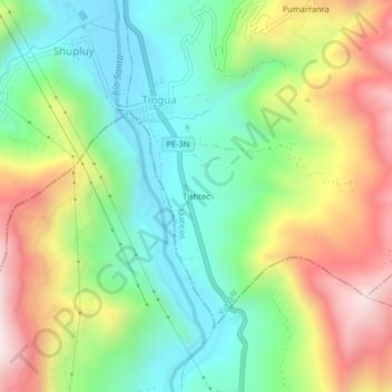
Name: Tishtec topographic map, elevation, terrain.

Location: Tishtec, Tingua, Mancos, Yungay, Áncash, Perú (-9.25284 -77.70237 -9.21284 -77.66237)

Average elevation: 2,803 m

Minimum elevation: 2,475 m

Maximum elevation: 3,316 m

Gear up for your next adventure:

💧Hydration Pack - Hands-free hydration system for long hikes
🥾Approach Boots - Comfortable boots for hiking and climbing approaches
🧊Portable Cooler - Keep food and drinks cold during outdoor adventures
🔥Emergency Fire Starter - Reliable ignition source for all weather conditions
🎒Hiking Backpack - Lightweight and ergonomic backpacks for day hikes or multi-day treks

As an Amazon Associate, this site earns from qualifying purchases at no extra cost to you.