Geolocate

Ibach topographic map

Click on the map to display elevation.

About this map

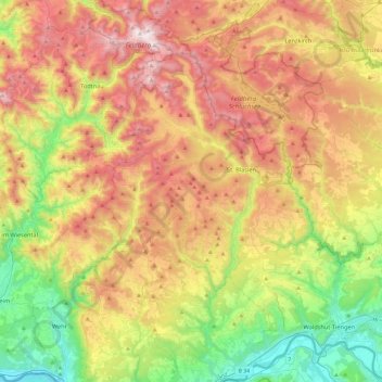
Name: Ibach topographic map, elevation, terrain.

Location: Ibach, Landkreis Waldshut, Baden-Württemberg, 79875, Germany (47.58169 7.90900 47.90169 8.22900)

Average elevation: 820 m

Minimum elevation: 277 m

Maximum elevation: 1,491 m

Gear up for your next adventure:

💧Hydration Pack - Hands-free hydration system for long hikes
🦟Insect Repellent - Keep mosquitoes and black flies away in wooded areas
🥾Mountaineering Boots - Supportive boots for climbing and high-altitude hiking
🌡️Emergency Mylar Blankets - Compact thermal protection for unexpected nights outdoors
🧳Compression Sacks - Maximize space in your backpack by shrinking gear

As an Amazon Associate, this site earns from qualifying purchases at no extra cost to you.