
Thank you for supporting this site ❤️
Make a donation
Make a donation
Gear up for your next adventure:
As an Amazon Associate, this site earns from qualifying purchases at no extra cost to you.
Glenrock topographic map
Click on the map to display elevation.
Thank you for supporting this site ❤️
Make a donation
Make a donation
Gear up for your next adventure:
As an Amazon Associate, this site earns from qualifying purchases at no extra cost to you.
About this map
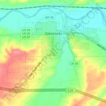
Name: Glenrock topographic map, elevation, terrain.
Location: Glenrock, Converse County, Wyoming, 82637, United States (42.83762 -105.89152 42.86838 -105.82955)
Average elevation: 1,546 m
Minimum elevation: 1,508 m
Maximum elevation: 1,609 m
Thank you for supporting this site ❤️
Make a donation
Make a donation
Gear up for your next adventure:
As an Amazon Associate, this site earns from qualifying purchases at no extra cost to you.