Geolocate

Shikhar Shinganapur topographic map

Click on the map to display elevation.

About this map

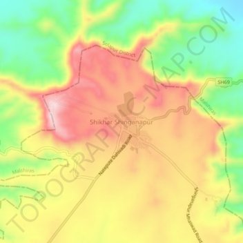
Name: Shikhar Shinganapur topographic map, elevation, terrain.

Location: Shikhar Shinganapur, Man, Satara, Maharashtra, India (17.83012 74.64391 17.87012 74.68391)

Average elevation: 767 m

Minimum elevation: 609 m

Maximum elevation: 909 m

Gear up for your next adventure:

🔦LED Headtorch - Bright and durable light for night activities
🥾Hiking Leggings - Comfortable leggings for outdoor activities
🧴Insect Repellent - Protect yourself from bugs during outdoor adventures
🥾Lightweight Hiking Boots - Boots for comfort and mobility on long hikes
🪑Insulated Seat Pad - Protect your seat from cold rocks and wet logs

As an Amazon Associate, this site earns from qualifying purchases at no extra cost to you.