
Gochsheim topographic map
Click on the map to display elevation.
About this map
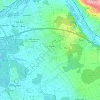
Name: Gochsheim topographic map, elevation, terrain.
Location: Gochsheim, Landkreis Schweinfurt, Bavaria, 97469, Germany (49.99267 10.23469 50.04078 10.33555)
Average elevation: 231 m
Minimum elevation: 204 m
Maximum elevation: 358 m
Other topographic maps
Click on a map to view its topography, its elevation and its terrain.
Michelau i.Steigerwald
Germany > Bavaria > Landkreis Schweinfurt > Michelau i.Steigerwald
Average elevation: 333 m