Geolocate

Cima Robert topographic map

Click on the map to display elevation.

About this map

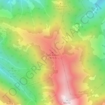
Name: Cima Robert topographic map, elevation, terrain.

Location: Cima Robert, Roburent, Cuneo, Piemonte, Italia (44.21481 7.87213 44.21491 7.87223)

Average elevation: 1,554 m

Minimum elevation: 1,174 m

Maximum elevation: 1,978 m

Gear up for your next adventure:

🧶550 Survival Paracord - Versatile utility cord for emergency repairs and rigging
🛏️Sleeping Bag - Warm and compact sleeping bags for outdoor camping
🥾Durable Hiking Shoes - Long-lasting shoes for frequent hiking
🛌Insulated Sleeping Pad - Critical thermal barrier between you and the cold ground
👟Sport Hiking Sandals - Breathable footwear for water crossings and camp rest

As an Amazon Associate, this site earns from qualifying purchases at no extra cost to you.