Geolocate

Lakeville topographic map

Click on the map to display elevation.

About this map

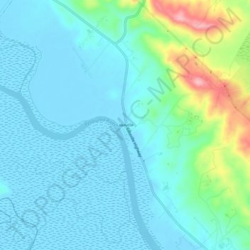
Name: Lakeville topographic map, elevation, terrain.

Location: Lakeville, Sonoma County, California, United States (38.17908 -122.56720 38.21908 -122.52720)

Average elevation: 28 m

Minimum elevation: -4 m

Maximum elevation: 146 m

Gear up for your next adventure:

🧤Thermal Hiking Gloves - Grip-enhanced gloves for cold-weather altitude trekking
🔋Lithium AA Batteries - Long-lasting power that performs in extreme cold
🧢Outdoor Cap - Protective cap for sun and rain during hikes
🥾Light Hiking Boots - Lightweight and comfortable boots for day hikes
🏃Hydration Running Vest - Carry water and maps close to your body for speed

As an Amazon Associate, this site earns from qualifying purchases at no extra cost to you.