Geolocate

Buhingtubig topographic map

Click on the map to display elevation.

About this map

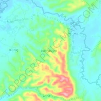
Name: Buhingtubig topographic map, elevation, terrain.

Location: Buhingtubig, Cebu, Central Visayas, 6039, Philippines (10.27273 123.59651 10.31273 123.63651)

Average elevation: 45 m

Minimum elevation: 2 m

Maximum elevation: 162 m

Gear up for your next adventure:

🥾Lightweight Hiking Shoes - Comfortable shoes for day hikes
🧥Packable Rain Jacket - Breathable waterproof layer for unpredictable weather
💧Collapsible Water Bottle - Space-saving water bottle for outdoor activities
🧦Outdoor Socks - Durable socks designed for hiking and outdoor sports
Lightweight Backpacking Tent - Compact tent for efficient hiking trips

As an Amazon Associate, this site earns from qualifying purchases at no extra cost to you.